What is the Palouse?
Some places are easy to define: A country, a state, a county, a city. Some places less so. The Palouse region is one of these more difficult to define places. Most generally the region lies along the banks of the Palouse River. It is the ancestral home of the Palouse (Palus) tribe, the grassland ecological area, and the rolling hills. There are many disagreements on the boundaries of this region. Everyone seems to have a differing idea of the east and south boundaries of the region, though most people agree that the northern edge is south of Spokane, around where the evergreens begin, and that the western edge is somewhere west of Dusty and east of Washtucna. The southern edge may reach as far south as Pendleton Oregon (Palouse Grassland) or only so far as the top of the grade down into Lewiston and Clarkston. The eastern edge may go just east of Moscow, or halfway through the Clearwater Mountains.
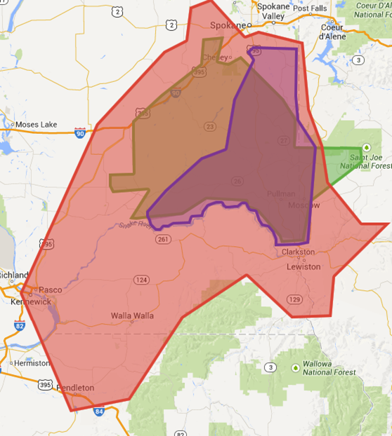
On the map, the
red area represents
the ecological Palouse Prairie, grassland that has been almost entirely converted into single crop farming because of the rich soil. The
green area is a
map that was published in the Seattle Times depicting another possibility. The
purple map is a
core area that a number of region experts made in the
mid 1990s. The
grey area where
all 3 maps overlap is the boundary we are using at the library.
Everyone seems to have a different idea of the Palouse. What is the Palouse Region to you?
by Lisette Scheer
Palouse Heritage Assistant

No comments:
Post a Comment